Autark: A Serverless Toolkit for Prototyping Urban Visual Analytics Systems
arXiv preprint, 2026


Autark
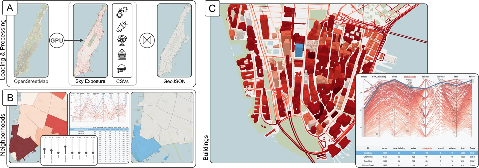
Load, process, and visualize geospatial data entirely in the browser
Autark is a serverless toolkit for prototyping urban visual analytics systems. It loads, processes, and visualizes geospatial data entirely in the browser, through four packages:
Autark can also be used through a grammar, autk-grammar. Documentation, examples and a gallery are at autarkjs.org.
arXiv preprint, 2026
@misc{alexandre2026autark,
  title = {Autark: A Serverless Toolkit for Prototyping Urban Visual Analytics Systems},
  author = {Lucas Alexandre and João Rulff and Talisson Souza and Gustavo Moreira and Daniel de Oliveira and Claudio Silva and Fabio Miranda and Marcos Lage},
  year = {2026},
  eprint = {2604.20759},
  archiveprefix = {arXiv}
}